


Intro:
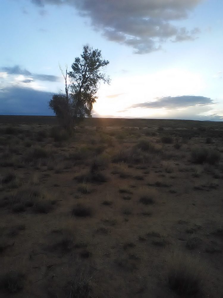
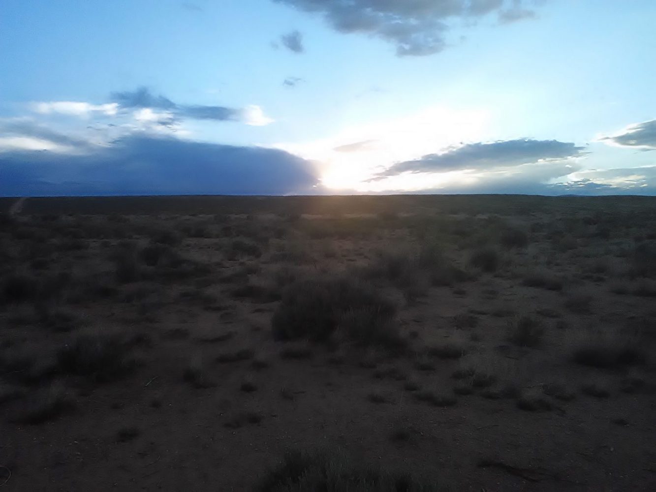
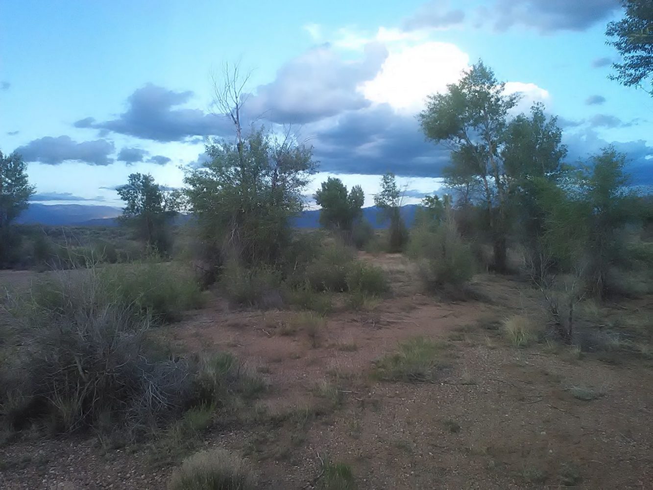
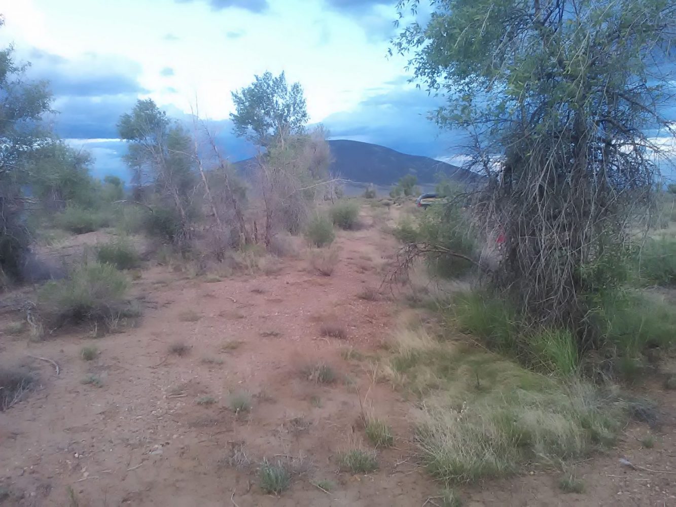
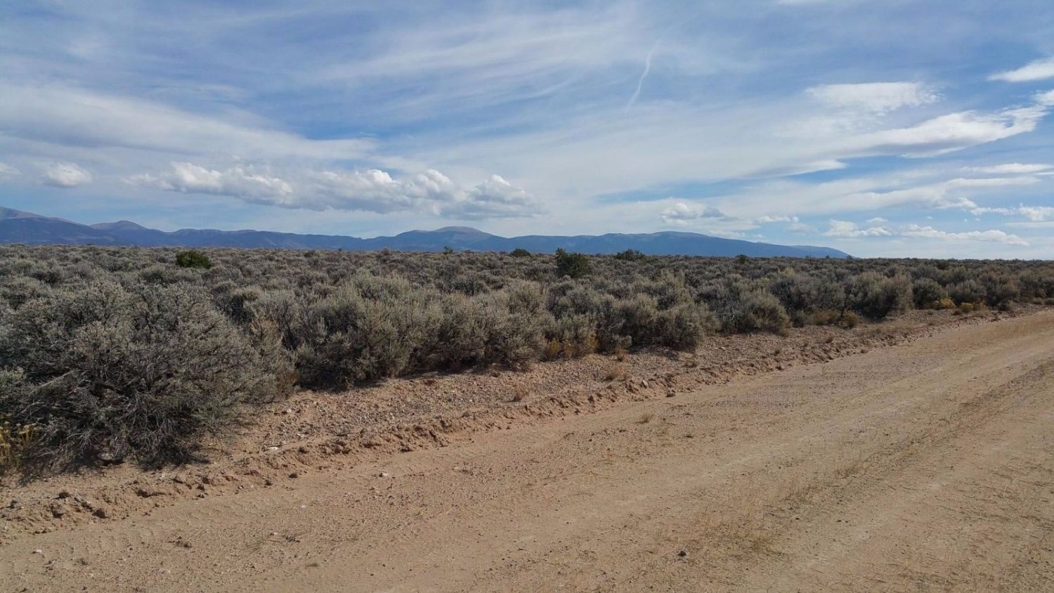
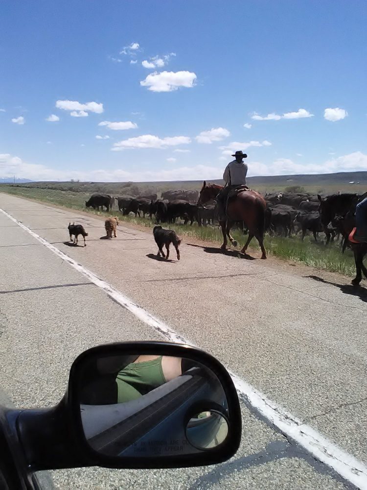
Imagine waking up to enjoy wild horses, antelope, and elk as they pass and even graze in your yard. Imagine yourself being able to have year around access to some of the most pristine land in America. Plenty of wildlife to watch or ride horses, motorcycles, and hunt right in your back yard. And if you enjoy fishing, this property is surrounded by some of Colorado’s top fisheries. With Mt. Blanca in your front yard and the Sangre De Cristo Range in your back yard! Getaway for the weekend, bug out pad. Great camping or building sites with abundant wildlife and great views!
Property Specifics:
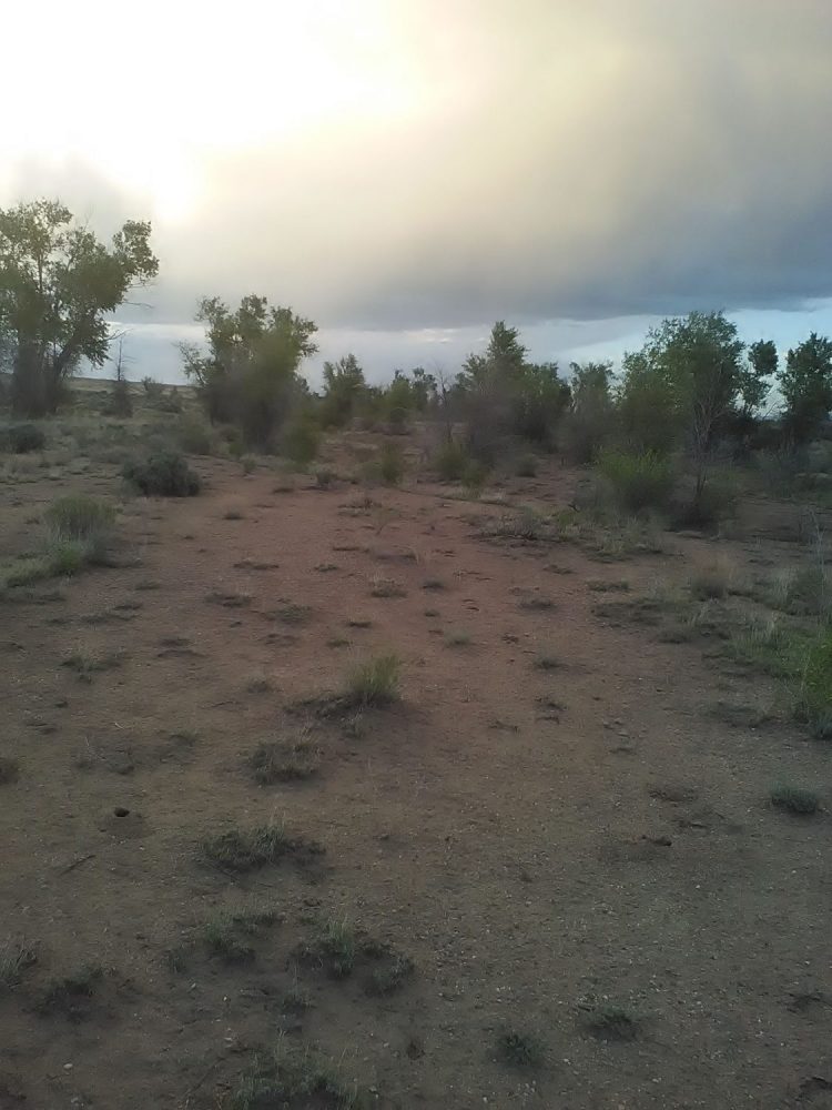
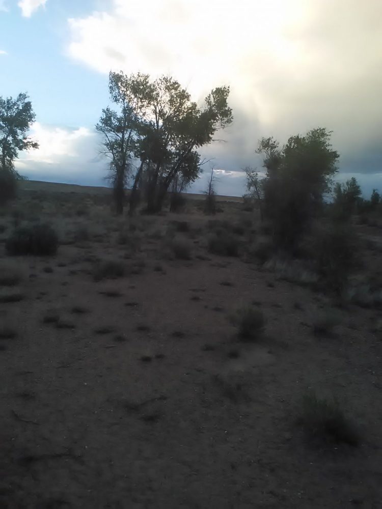
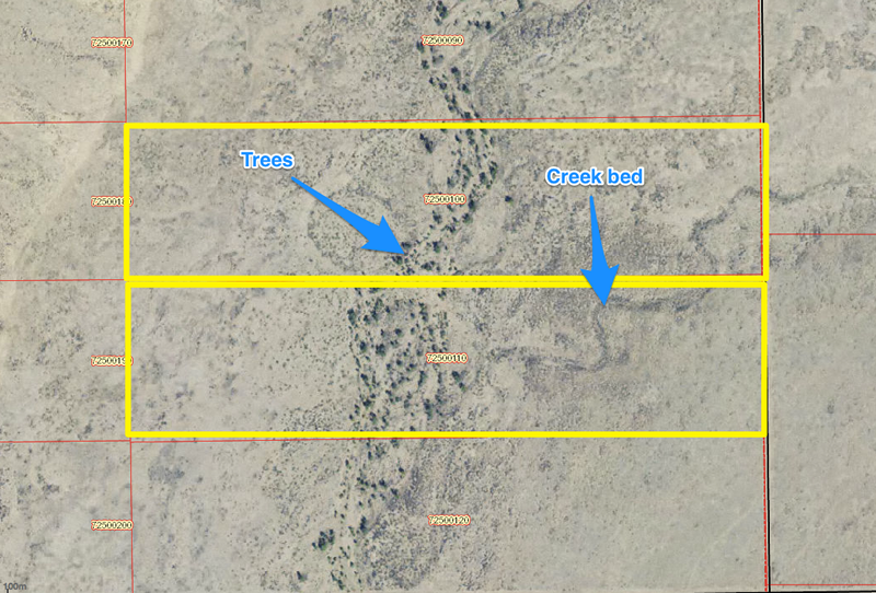
As 40-acre parcels go, these two are special, with trees and water. Currently available to purchase individually or save and buy both parcels together as an 80-acre parcel.
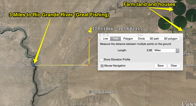
Located under 3 miles from the Rio Grande river, the depth needed to reach water for your well is only ft, greatly reducing well digging costs. Power is nearby due to a nice new home being built nearby (see photos).
There is a small seasonal creek running through both parcels and both parcels feature some trees and vegetation.
Cash Price: $12,997.00/40 acre parcel or by all 80 acres for $23,994.00
Doc Fee: $299.00 per parcel
Title Special Warranty Deed
Assessor’s Parcel Number (APN) 72500110, 72500120
Legal Description Costilla Creek Ranches Tract M Cont. 40 Ac In Sec 29-1-74
Location (nearest town/zip) San Luis, 81152
GPS Coordinates (Latitude/Longitude)
*These coordinates can be pasted or typed into any GPS, or any online mapping program likes Google Maps, MapQuest, Bing Maps, etc.
APN 72500120
NW Corner: 37.011769, -105.691096
SW Corner: 37.009998, -105.691072
NE Corner: 37.011844, -105.682109
SE Corner: 37.010055, -105.682061
GPS Coordinates
APN 72500110
NW Corner: 37.013568, -105.691139
SW Corner: 37.011788, -105.691079
NE Corner: 37.013674, -105.682139
SE Corner: 37.011866, -105.682115 (Black Hawk Rd & County Rd B)
Zoning Residential
Utilities (Specific to parcel)
There is a new home very close, meaning power may already be close by Call (San Luis Valley Rural Electric: 719-852-6654) for specifics.
*Previous owners had good depth tested: Only 120ft deep due to proximity to the river.
Showings Available Yes- with an appointment to serious buyers only after deposit is made.
Additional Property Info
GPS Coordinates presented here are based upon the best date we have accumulated, but are not exact. The information is for the purpose of locating your property only. Prior to building a fence or any structure on your land, you should contact a Colorado licensed surveyor to mark the exact corners of your property.
Distance to San Luis 35 mi
Distance to Pueblo 138 mi
Distance to Alamosa 42 mi
Distance to Ft Garland 51 mi
Distance to Taos 53 mi
Distance to Santa Fe 123 mi
About Costilla County and the San Luis Valley
Zapata is a small, gated mountain community in southern Colorado’s San Luis Valley, with about 950 home sites freckling the western slope of Blanca Massif. Most lots range from .8 acres to 1.5 acres and enjoy a combination of sun and shade from plentiful pinion, evergreen, aspen and cottonwood trees. Residents enjoy the use of two stocked lakes, a large, year-round stream and numerous hiking and recreation opportunities.
Zapata looks out over the expansive valley to the San Juan mountains on its far edge, and residents enjoy colorful sunsets and some of the most striking views in the area. The dramatic, ever-changing dunes of Great Sand Dunes National Park and Preserve are visible from many lots and common areas, and enchanting Zapata Falls is just down the road to the south. Across the street from the gated Zapata entrance is the historic Zapata Ranch, operated today by the Nature Conservancy.
Zapata has an active homeowner’s association that governs its development.
The San Luis Valley
The San Luis Valley, North America’s largest alpine valley, sits on the south-central border of Colorado and New Mexico, beginning just above of Taos, NM and extending north to Poncha Pass, near Villa Grove, CO. Highways 160 (east-west) and 285 (north-south) are the region’s primary transportation veins.
Zapata is located at the eastern edge of the valley, at the junction of Highway 150 and Lane 6 North — about 15 miles east of the town of Mosca and five miles south of Great Sand Dunes National Park and Preserve.
The San Luis Valley sits at about 7,500 feet above sea level, in a semi-arid region ringed on all sides by mountains. The climate is dry and temperate for three seasons, with sunny, warm, pleasant summers and cool, breezy springs and falls. Winters can be harsh, with daytime temperatures averaging in the 20s and often dipping well below zero at night. Snowfall is common from October through April and accumulates in the foothills and mountains (including Zapata), usually melting off quickly in the lower elevations.
Great Sand Dunes National Park and Preserve
Just north of Zapata is one of North America’s largest dune fields, and one of the most biologically diverse parks in the United States. Miles of drifting, changing, ethereal dunes stretch out in every direction and soar as high as 700 feet above visitors. In the lush landscape surrounding the dunes, mule deer, elk, black bears, mountain lions, coyotes, eagles, hawks and other wildlife share the park with more than 300,000 visitors each year. Many of these animals share a community backyard with Zapata residents.
More information about the park
Surrounding area
Mosca and Hooper
These two small, rural towns on State Highway 17 serve as the gateway to Zapata and the Great Sand Dunes for travelers coming from points north. Mosca is home to the Colorado Gator Park (you read that right!) and the Mosca Pit Stop, a convenience store, gas station and popular, local watering hole. Just north of Mosca near Hooper are the famed UFO Watchtower, a collection of other-worldly memorabilia and a raised platform for prime outer space viewing. Hooper is also home to the Hooper Pool – a deceptively simple name for a divine, geothermal swimming experience.
Crestone
Called the Hamlet of the San Luis Valley, Crestone is a small but active arts community on the north side of the Great Sand Dunes National Park and Preserve. Holistic living, eco-building, solar power and other modern, back-to-the-land values are popular here, as is a connected community devoted to artisan culture.
Blanca, Fort Garland, and San Luis
This trio of small towns on the southeastern edge of the San Luis Valley has a rich Hispanic history visible in their architecture and community events. Blanca’s two small grocers are a popular place for Zapata residents to stop for the basics, and the community center along US Route 160 between Blanca and Fort Garland offers residents an array of fitness and educational opportunities at low cost.
San Luis, just a few miles from the New Mexico border, is seeing a resurgence in its arts and cultural community. Between these three towns, there’s no shortage of hometown-style diners – both Mexican and American – to choose from.
Alamosa and Monte Vista
The business and cultural center of the San Luis Valley, Alamosa is home to just under 10,000 people, dozens of dining options, several hotels, retail stores, grocery stores, parks, galleries, the fabled Rio Grande and its namesake, the Rio Grande Scenic Railroad.
Despite being just half that size, Alamosa’s sister city, Monte Vista, is also bustling, with a charming, active downtown, a rural livestock events center and a wildlife refuge that’s home to some 25,000 migrating Sandhill Cranes each spring and fall.
Other unique facts and fables about the area
The San Luis Valley covers an area of about 8,000 miles, about the size of the state of Connecticut, but its total population is less than 50,000.
The valley’s economic engines are tourism and agriculture. Potatoes and barley are the main crops.
There are more than 500 known artists living in the San Luis Valley today.
Native American legend holds that the San Luis Valley is the site of “Sipapu,” or place of emergence. They believe their ancestors gathered to this special place to be led underground and await the cleansing of the earth and the coming of the new world. It’s believed that the exact spot of Sipapu is near the San Luis Lakes, not far from Zapata.
Eighty acres of fields outside Mosca are now home to the largest solar installation of its kind in North America.
The San Luis Valley enjoys more than 300 days of sunshine each year.
Links to more information
San Luis Valley Info: SLV Dweller
Alamosa Info: Alamosa Convention and Visitor’s Bureau
SLV News Wiki Valley Courier
The San Luis Valley on Wikipedia
Tax Collector Office: http://www.colorado.gov/cs/Satellite/CNTY-Costilla/CBON/1251595035177
Property Appraiser Office: http://www.colorado.gov/cs/Satellite/CNTY-Costilla/CBON/1251594973867
General Area Info about Utilities and Services
Electricity: (San Luis Valley Rural Electric: 719-852-6654) or (Xcell Energy xcelenergy.com) The Rural Electric Association has power throughout the valley, providing power to outlying areas. Property owners may obtain their extensions depending upon their location. It may be desirable and cost effective to install a privately owned generator or solar/generator power supply. Some recent owners installed Photovoltaic Panels and residential windmills. Propane gas service is available through several companies located in nearby towns.
Water: Individual wells for household purposes may be drilled on most parcels. Many choose to have tanks delivered. Permits and requirements should be confirmed by the Colorado Division of Water Resources office, 719-589-6683.
Sewer: Septic tank and leach field systems are required. Permits and requirements should be confirmed by the Costilla County Land Use Office, 719-672-9109. *You must adhere to county health and safety code if you intend to live on the property.
Telephone: Cellular phone service is available and phone lines vary in distance from the home sites, according to your location.