

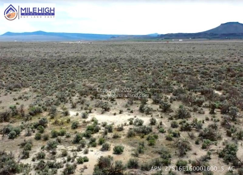

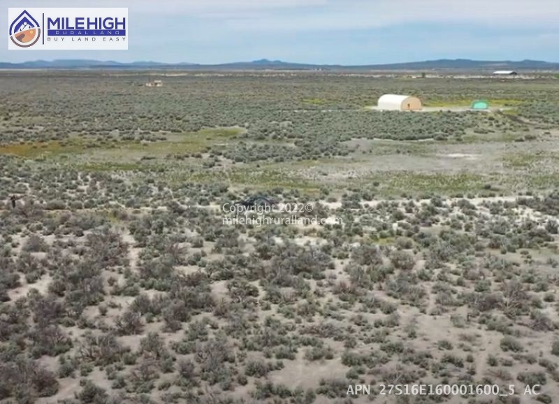

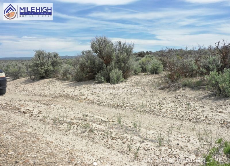
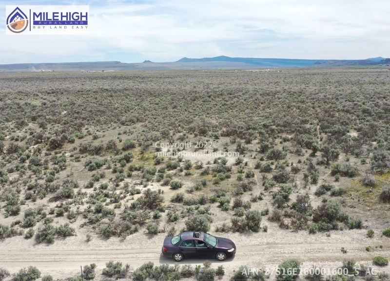
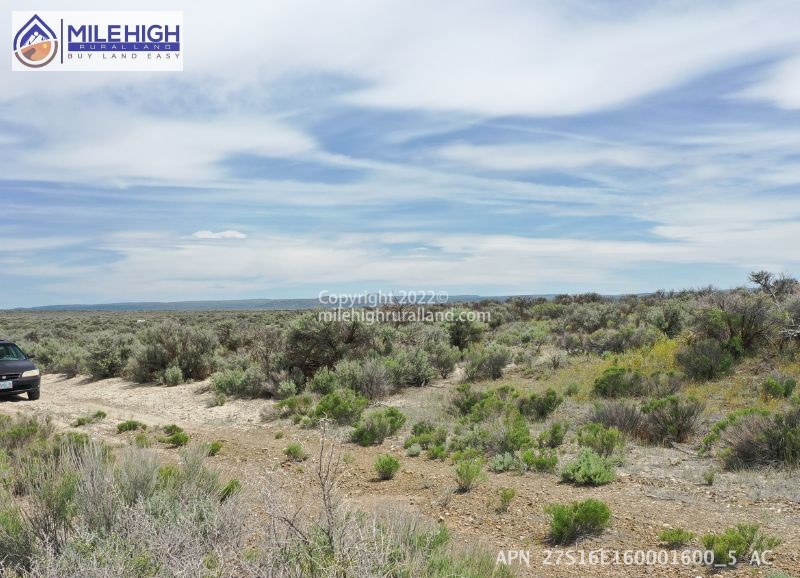
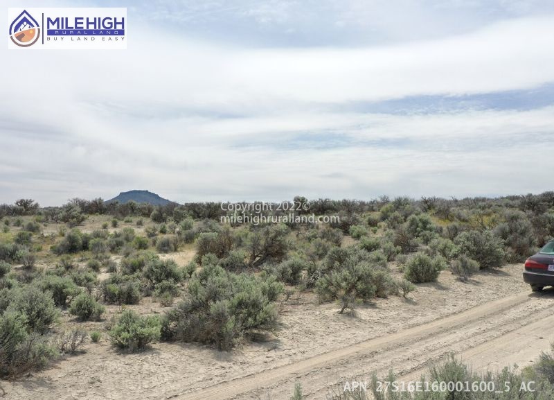
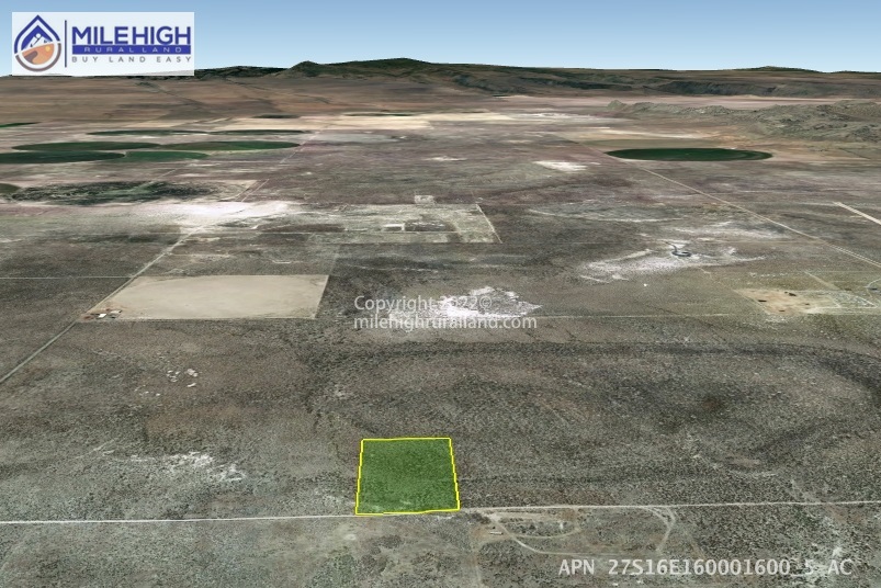

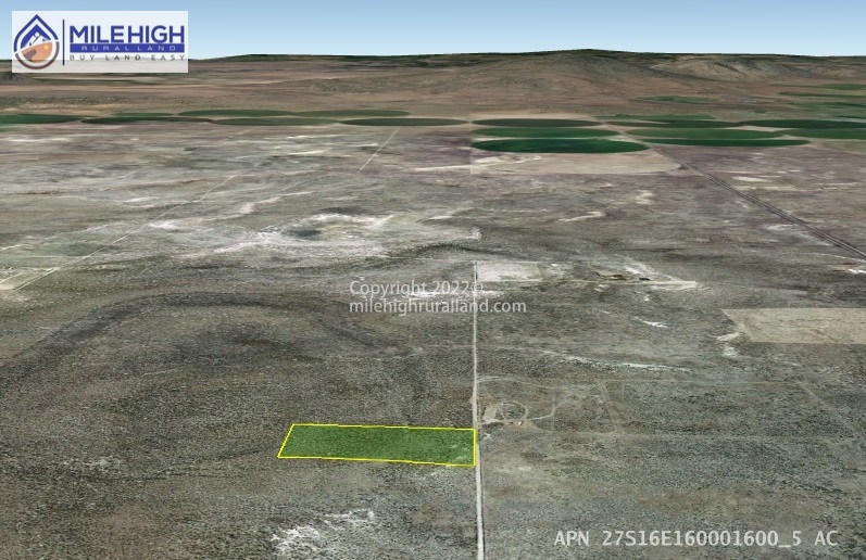


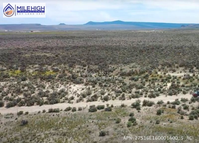

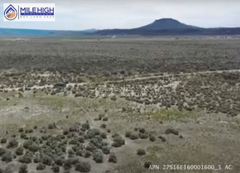


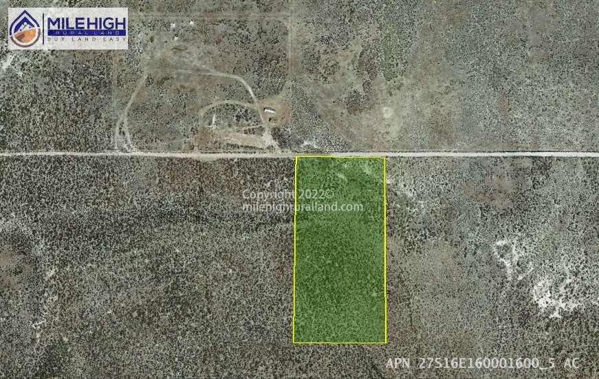

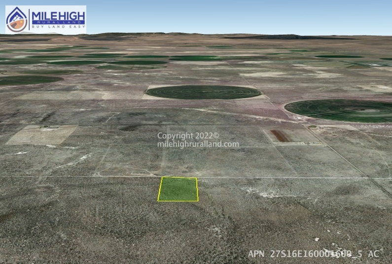


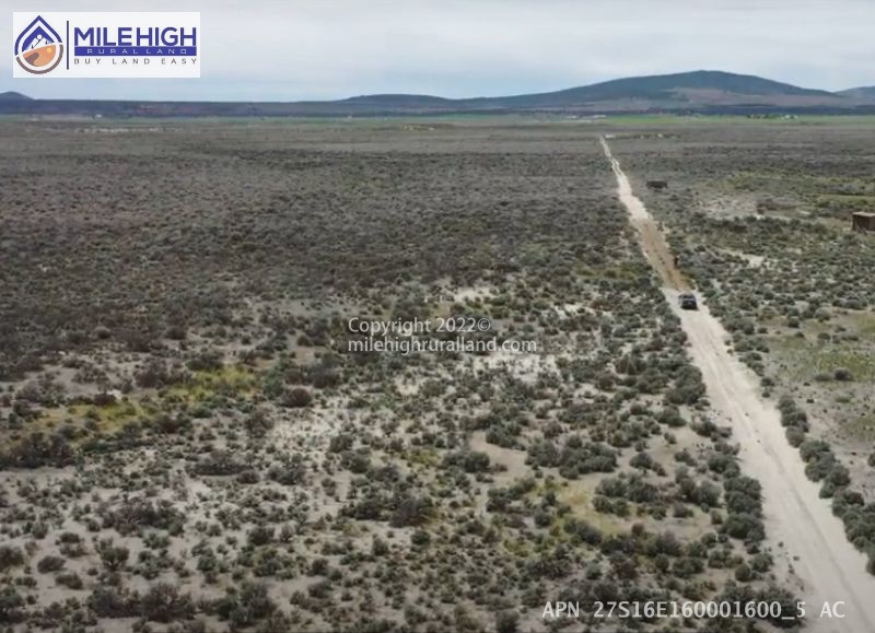
This lot is the perfect size for a single residential homesite, tucked in a flat, open landscape. The land is thickly covered with sagebrush and other high desert foliage, therefore some clearing may be desired. Indulge in the fantastic sights of gorgeous high desert landscape, breathtakingly vast skies with an ever-changing display of color, and glittering night skies filled with stars. Abundant wildlife wanders through the property, offering many awe-inspiring sightings and encounters.
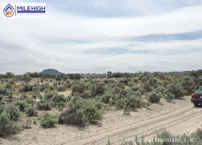
The property has easy road access. A few neighbors have built beautiful traditional homes, and moved manufactured homes, giving some inspiration for the possibilities of this property.
We offer down payment assistance program. Call us to set up!
Nearby Attractions
Enjoy this small farming community with all its amenities. Find entertainment at the golf course, touring the geographic sites, or spending the day at the famous sand dunes.
Baert Lake is less than 14 minutes’ drive from the property, presenting opportunities for fishing, boating, and swimming from spring through autumn and for ice skating in winter.
An ancient volcanic fissure, Crack-in-the-Ground offers one of the most fascinating hikes in central Oregon. Only 36 minutes’ drive from the property. A dirt trail leaves the sagebrush behind and descends into the fissure, which measures two miles long, 15 feet wide and up to 70 feet deep. With cooler air temperatures and a damp environment, walking through Crack-in-the-Ground is like exploring an incredible open-air cave.
An imposing rock formation and Oregon state park site, Fort Rock is 26 minutes’ drive Northwest of the property. This natural wonder is easily visible from the road. The formation is a naturally occurring volcanic tuff ring, formed when the Fort Rock/Christmas Valley Basin was a prehistoric inland sea. The resulting island and surrounding formations were home to some of the earliest recorded human settlements in North America.
Another nearby volcanic landmark with a literal name, Hole-in-the-Ground is a big explosion crater (known as a maar), measuring nearly a mile across. The neighboring Big Hole is an older, more eroded maar formation.
When thinking of sand dunes, one might imagine the Oregon coast. However, in the desert of central Oregon is another set of dunes, covering 11,000 acres of land and reaching up to 60 feet high. The largest inland shifting sand dune system in the Pacific Northwest, the Christmas Valley Dunes are managed by the Bureau of Land Management and open primarily for off-highway vehicles like ATVs and dirt bikes. Hikers can explore the dunes as well – with an eye out for any vehicles careening down the sand.
Fossil Lake is a dry lakebed on the southeast side of the Christmas Valley Sand Dunes, well known among paleontologists as a site for fossils. The ancient lake that once filled the area is thought to have been 200 feet deep, over time slowly drying up and leaving behind remains of the many prehistoric animals that visited its shores.
Located on the northeast side of the Christmas Valley Sand Dunes, Lost Forest is what remains of an ancient ponderosa pine forest that once covered much of the region. The isolated stand of trees seems out of place in the sagebrush prairie, a surreal sight that seems to echo from another time.
Additional Notes:
Mobile Homes: Mobile homes are allowed with permits only.
RV: Camping and RV’s are allowed for short periods of time.
Do you want to arrange a visit to the property?
You are welcome to visit our properties anytime you like. Simply contact us to schedule a time so that we can be sure the property is still available before you drive out to it. We operate an eCommerce land business, and we typically do not accompany property visits.
Call, text or email for more info today! 866-707-DIRT(3478)
Buyers are responsible to do their own due diligence.